3D Modelling of industrial infrastructure projects improves design understanding
December 6, 2022
Associated has a large and extensive portfolio of industrial landfill projects to serve our clients’ waste management needs. Our experience includes new landfills, landfill expansions, and landfill capping, as well as design of associated infrastructure, such as roads, leachate ponds, and stormwater ponds. Our work on these projects ranges from multi-discipline engineering design and regulatory approvals to construction inspection. Jeff Chan, Civil Project Engineer advises, “We are often the primary consultant for clients, tasked with delivering engineering design, and providing environmental services and construction quality assurance.”
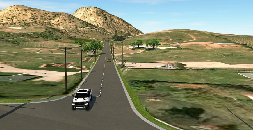
Traditionally, these projects have been delivered using two-dimensional drawings. Today, enhanced visualization tools, such as InfraWorks and drones, provide project teams and clients with a three-dimensional model which offers more clarity on the design. Jeff tells us, “The 3D model helps clients, operations staff, regulators, and other stakeholders to understand the intent of the design and key components. For road projects, InfraWorks is used to show the layout of upgrades and provide fly-by videos of the project.”
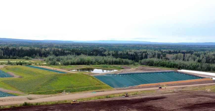
Our teams employ these enhanced visualization tools throughout the design and construction life-cycle. During construction, drone mapping is used to provide daily site updates to clients and our office-based personnel.
Many of our industrial landfill projects are in remote locations. Thus, typically, office-based personnel only see construction progress through photos taken by inspectors in daily reports, or during site visits. Typical photography has limitations, as it does not capture the entire site. Jeff tells us, “Drones can capture project construction from angles not possible by other means. Drone photos and videos assist us to explain and report the progress of construction to the project team and clients.”

Using a tool called DroneDeploy, we process the collected drone mapping data into a plan view of the site, as well as a 3D view. Stakeholders can then see the actual daily progress of construction, identify areas of potential interest or concern, view surface profiles, and complete approximate measurements of distances and areas.
Employing modern visualization tools, everyone involved on a project has a better understanding and is more engaged with the design and construction, which results in a better final product.


